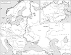
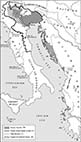
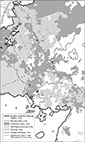
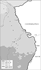
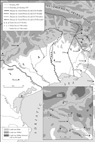
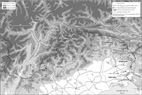
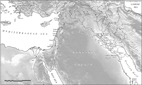
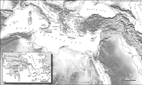
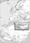
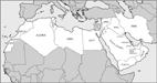
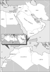
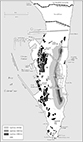
Click on any map to see it enlarged.
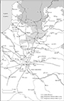
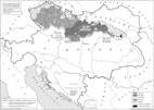
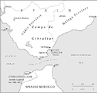
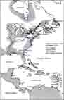
Examples of maps that I have both compiled and drawn on screen: next
 |
 |
 |
 |
|
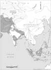
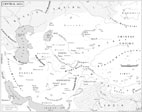
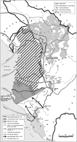
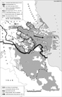
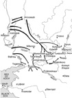
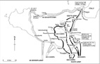
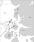
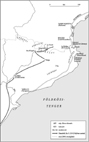
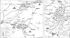
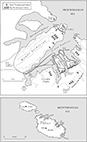
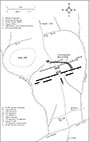
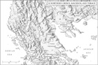
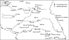
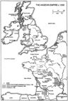
H1
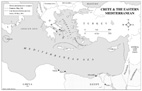
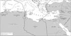
- Crete & the Eastern Mediterranean |
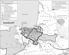
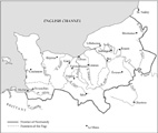
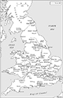
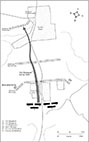
H2
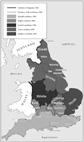
- England, 1066 |
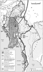
H3
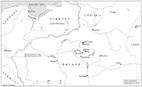
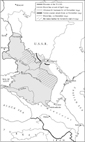
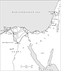
- Botchki in Eastern Poland |
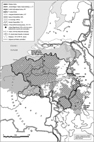
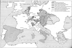
H4
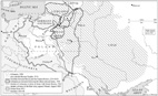
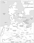
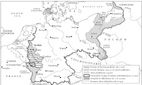
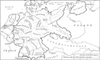
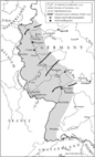
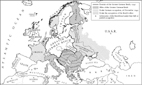
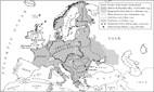
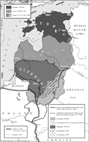
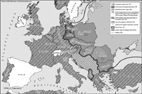
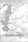
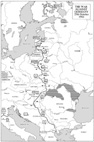
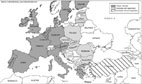
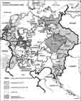
- Changing frontiers between the Baltic and the Black Sea, 1500-1938 |
 |
 |
 |
 |
|
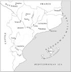
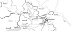
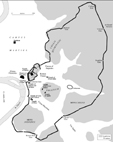
H5 - Aragon C14 |
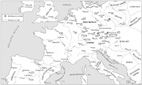
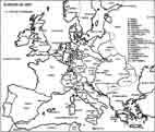
H6 - Europe, C14 |
H7 - Baltic Lights |
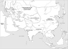
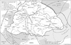
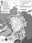
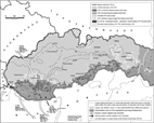
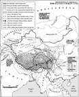
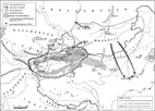
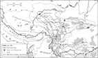
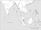
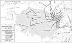
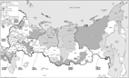
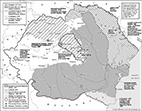
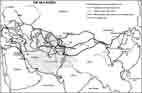
H8 - Mongol Empire |
 |
 |
 |
 |
|
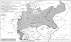
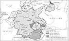
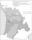
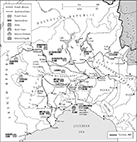
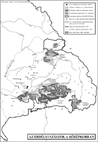
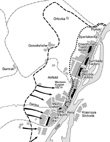
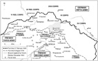
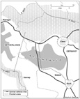
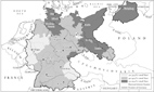
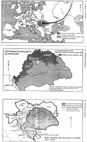
H9 - Germany 1864 - 1871 |
H10 - Germany 1871-1921 |
H11 - Germany in WWI |
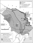
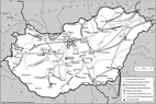
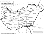
H12 - Hungary 1000-1300 |
 |
 |
 |
|
|
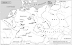
H13
- Dar al-Islam, 1750 (West) |
H14
- Dar al-Islam, 1750 (East) |
H15
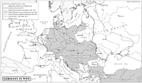
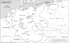
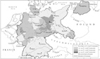
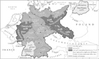
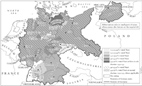
- Germany |
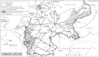
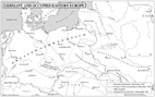
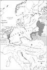
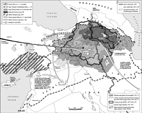
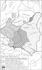
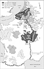
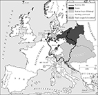
H16
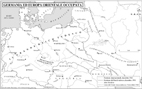
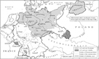
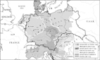
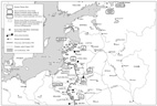
- Germany and Occupied Eastern Europe |
 |
 |
 |
 |
|
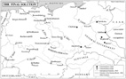
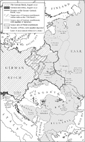
H17
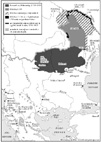
- The ‘Final Solution’
|
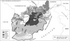
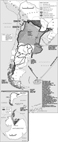
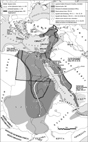
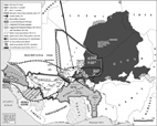
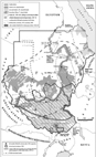
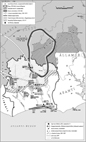
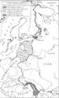
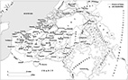
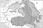
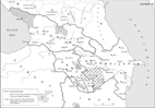
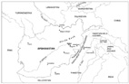
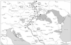
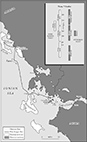
H18 - Central Asia, 1830 |
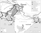
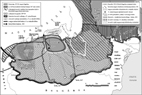
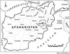
H19 - Afghanistan-Ethnicity |
H20 - Afghanistan, camps, airports |
 |
 |
 |
 |
|
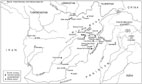
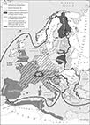
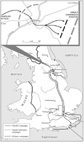
H21
- War in Afghanistan
|
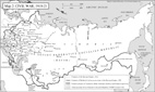
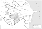
H22
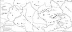
- Civil War in Russia
|
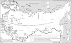
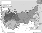
H23
- The USSR, 1929
|
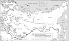
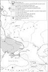
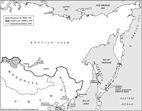
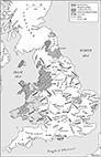
H24
- The USSR, 1939
|
|
|
|
|
|
 |
 |
 |
 |
|
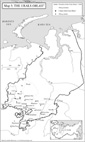
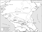
H25
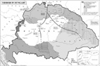
- The Urals Oblast’
|
H26
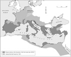
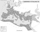
- Roman Empire, 2BC
|
H27
- Chaucer’s route, 1372-73
|
H28
- Hawkwood properties, 1382
|
 |
 |
 |
 |
|
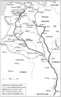
H29
- Europe, 1942
|
H30
- The Versailles treaty
|
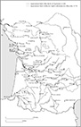
H31
- German expansion in WW1 (West)
|
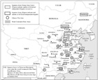
H32
- German expansion in WW1 (East)
|
 |
 |
 |
 |
|
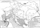
H33
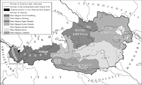
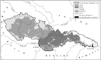
- Habsburg Monarchy, ethnical
|
H34
- Religions in Germany, 1920’s
|
H35
- Germany, 1938 (Italian)
|
H36
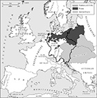
- Germany and Occupied Eastern Europe (Italian)
|
 |
 |
 |
 |
|
H37
- Yiddish in Hungary
|
H38
- Aromanians
|
H39
- Albania
|
H40
- Reach for the Arctic
|
 |
 |
 |
 |
|
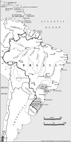
H41
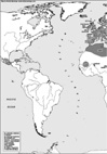
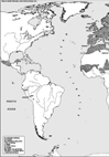
- Argentina in history
|
H42
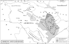
- Armenia
|
H43
- Azerbaijan
|
H44
- The Basques
|
 |
 |
 |
 |
|
H45
- Belgium’s genesis
|
H46
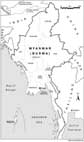
- Burma in history
|
H47
- Catalonia in history
|
H48
-Ceylon in history
|
 |
 |
 |
 |
|
H49
- Sino–Japanese relations
|
H50
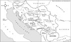
- Croatian history
|
H51
- Croatia 1918–1995
|
H52
-Egypt in history
|
 |
 |
 |
 |
|
H53
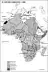
- EU: imperial inheritance
|
H54
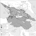
- Georgia in history
|
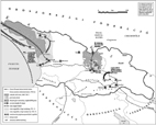
H55
- War in Georgia
|
H56
-Haiti in history
|
 |
 |
 |
 |
|
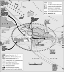
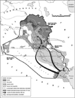
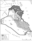
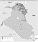
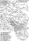
H57
- Iraq, 1991–2003
|
H58
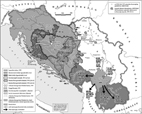
- ‘Yugoslavia’ in history
|
H59
- Yugoslavia, 1940–54
|
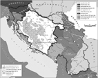
H60
-Yugoslavia from 1990
|
 |
 |
 |
 |
|
H61
- Korea in history
|
H62
- Kosovo in history
|
H63
- Kurdistan in history
|
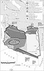
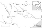
H64
-Libya in history
|
 |
 |
 |
 |
|
H65
- Mali in history
|
H66
- Moldavia in history
|
H67 - Pakistan
|
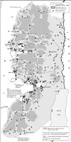
H68
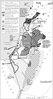
-Palestinians to 1982
|
 |
 |
 |
 |
|
H69
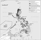
- Palestinians, 1994–2012
|
H70
- The Philippines in history
|
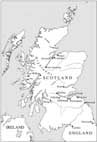
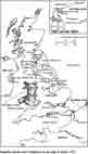
H71 - Scotland in history
|
H72 -Slovakia from 1918
|
 |
 |
 |
 |
|
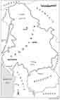
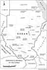
H73
- Sudan in history
|
H74
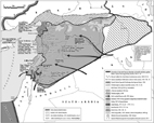
- Syria, 1916–2011
|
H75 - Tibet in history
|
H76 -Uyghur history
|
 |
 |
 |
 |
|
H77
- Wallachia in history
|
H78
- Ivory Coast to 2007
|
H79
- Hungarians in Slovakia
|
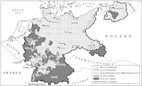
H80
- Nazi party regions
|
 |
 |
 |
 |
|
H81
- Religions
|
H82
- Motorways
|
H83
- Germans outside Germany
|
H84
- Saarland, Rhineland
|
 |
 |
 |
 |
|
H85
- Austria 1938
|
H86
- Czechoslovakia, ethnicity
|
H87
- Czechoslovakia, 1938–9
|
H88
- Germany 1938–9
|
 |
 |
 |
 |
|
H89
- Poland, 1939
|
H90
- German Population Transfers
|
H91
- Soviet expansion
|
H92
- Western German advance
|
 |
 |
 |
 |
|
H93
- France, 1940–43
|
H94
- Mediterranean war
|
H95
- Operation Barbarossa
|
H96
- New Order, 1942
|
 |
 |
 |
 |
|
H97
- Eastern front, 1942
|
H98
- Long retreat
|
H99
- End of WW2
|
H100
- Removal of Germans
|
 |
 |
 |
 |
|
H101
- Division of Germany
|
H102
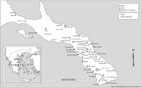
- Chukotka
|
H103
- Slovenia, 1900–55
|
H104
- French offers
|
 |
 |
 |
 |
|
H105
- Aquitaine
|
H106
- Flanders/Low Countries
|
H107
- Houses of influence
|
H108
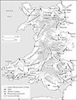
- Wales, c. 1400
|
 |
 |
 |
 |
|
H109
- Northwest France
|
H110
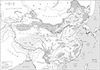
- China
|
H111
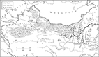
- NW China
|
H112
- SW China
|
 |
 |
 |
 |
|
H113
- SE China
|
H114
- NE China
|
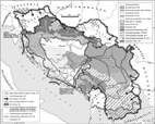
H115
- Iraq, ethnicity
|
H116
- Lebanon’s religions
|
 |
 |
 |
 |
|
H117
- Isonzo front
|
H118
- Italian demands
|
H119
- Theatre of war
|
H120
- Fighting by the Isonzo
|
 |
 |
 |
 |
|
H121
- Caporetto
|
H122
- Europe, 1789
|
H123
- Napoleon’s Italian campaign
|
H124
- Napoleon in Egypt
|
 |
 |
 |
 |
|
H125
- Napoleon’s 2nd Italian campaign
|
H126
- Europe, 1804
|
H127
- Europe, 1805
|
H128
- Europe, 1806/1807
|
 |
 |
 |
 |
|
H129
- Europe, 1811
|
H130
- The Mediterranean, 1560
|
H131
- Vasco da Gama’s voyage
|
H132
- Portugal in Asia
|
 |
 |
 |
 |
|
H133
- Papal World divisions
|
H134
- Russian Empire, 1913
|
H135
- Ungern in Mongolia
|
H136
- USSR/China
|
 |
 |
 |
 |
|
H137
- Italy 1796–1815
|
H156
- The Rhineland, 1789–1824
|
H157
- Napoleon’s Rhineland
|
H158
- Franco-Prussian war
|
 |
 |
 |
 |
|
H159
- Nazis/Muslim world
|
H160
- Muslims in the Western Balkans
|
H161
- Muslims of Crimea/Caucasus
|
H162
- Mediterranean Muslims
|
 |
 |
 |
 |
|
H164
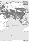
- The World in 1000 (West)
|
H165
- The World in 1000 (East)
|
H166
- The World in 1300 (West)
|
H167
- The World in 1300 (East)
|
 |
 |
 |
 |
|
H163
- The World, 700
|
H168
- Alsace-Lorraine
|
H169
- Alsace
|
H170
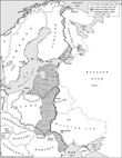
- The Baltic states, 1918¬–1991
|
 |
 |
 |
 |
|
H171
- Europe, 1727
|
H172
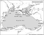
- Ancient Black Sea
|
H173
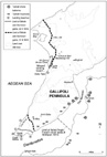
- Gallipoli
|
H174
- NATO/Warsaw Pact, 1956
|
 |
 |
 |
 |
|
H175
- Hungary, 1956
|
H176
- Soviet expansionism 1939–49
|
H177
- USSR’s European annexations
|
H178
- USSR’s Far Eastern annexations
|
 |
 |
 |
 |
|
H179
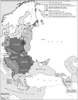
- Expansion of Muscovy/Russia
|
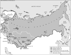
H180
- USSR, 1980
|
H181
- Collapse of USSR
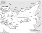
|
H182
- Russia, administration
|
 |
 |
 |
 |
|
H183
- Northern Caucasus
|
H184
- Romania, 1878–1968
|
H185
- The Tyrol front, 1916
|
H186
- The Italian front, 1915–17
|
 |
 |
|
 |
|
H187
- Positions, 1915–17
|
H188
- Ancient Mesopotamia
|
H189
- Hellenistic states
|
H190
- Greek world
|
 |
 |
 |
 |
|
H191
- Western front, WWI
|
H192
- Vittorio Veneto
|
H193
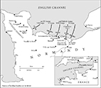
- The Normandy landing
|
H194
- Russian civil war
|
 |
 |
 |
|
|
H195
- Russian civil war in Europe
|
H196
- Roumania 1878–2013
|
H197
- Cities’ ethnicity, C16
|
H198
- Administration 1860–67
|
 |
 |
 |
 |
|
H199
- Trajan’s Empire
|
H200
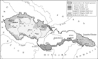
- Czechoslovakia
|
H201
- Transylvanian Saxons
|
H202
- Transcaucasia
|
 |
 |
 |
|
|
H203
- Azerbaijan
|
H204
- Fight at Khojaly
|
H205
- Western front
|
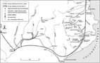
Examples of maps that I have drawn to order on screen: top, next
 |
 |
 |
 |
|
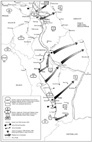
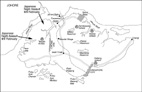
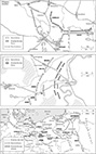
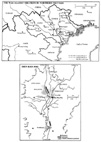
I1 - Advance to Caucasus |
I2 - Attack by the Donets |
I3 - Soviet Counterattack |
I4 - Stalingrad |
 |
 |
 |
 |
|
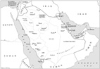
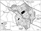
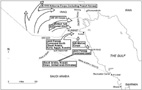
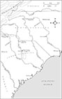
I5 - Saudi Arabia |
I6 - Milton Keynes |
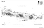
I7 - Crete |
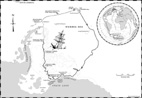
I8 - Shackleton’s Endurance |
 |
 |
 |
 |
|
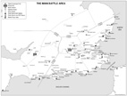
I9
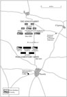
- The Main Battle Area |
I10
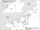
- Bases of Luftwaffe Combat Units, 13 August 1940 |
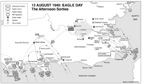
I11
- 13 August 1940: EAGLE DAY, The Afternoon Sorties |
I12
- In Siberia |
 |
 |
 |
 |
|
I13 - Constantinople, 1066 |
I14 - Normandy, 1066 |
I15 - Stamford Bridge |
I16 - Afghanistan |
 |
 |
 |
 |
|
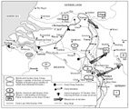
I17 - Burma, 25 October 1944 |
I18 - China, 25 October 1944 |
I19 - France, 25 October 1944 |
I20 - Holland, 25 October 1944 |
 |
 |
 |
 |
|
I21 - Western Europe, 25 October 1944 |
I22 - Eastern Europe, 25 October 1944 |
I23 - Russian Front South, 25 October 1944 |
I24 - Russian Front North, 25 October 1944 |
 |
 |
 |
 |
|
I25
- Leyte Island, 25 October 1944 |
I26
- Philippines (Leyte is.), 25 October 1944 |
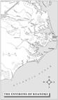
I27
- The Environs of Roanoke |
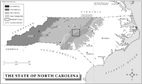
I28
- The State of North Carolina |
 |
 |
 |
 |
|
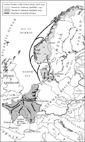
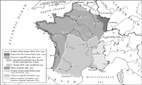
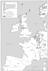
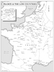
I29
- France and the Low Countries |
I30
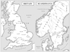
- Britain & Scandinavia |
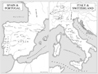
I31 - Spain & Portugal; |
I32
- Paris, C14 |
 |
 |
 |
 |
|
I33 - Arras-Lens |
I34 - Desert Storm |
I35 - River Plate |
I36 - Battle of Britain |
 |
 |
 |
 |
|
I37 - El Alamein |
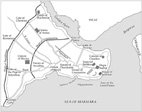
I38 - Gallipoli |
I39 - Jerusalem |
I40 - Ladysmith |
 |
 |
 |
 |
|
I41 - Passchendaele |
I42 - Sicily |
I43 - Singapore |
I44 - Verdun 1916 |
 |
 |
 |
 |
|
I45
- Western Front |
I46
- Wireless Ridge |
I47
- Ypres |
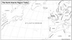
I48
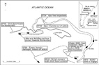
- The North Atlantic Region Today |
 |
 |
 |
 |
|
I49 - Ardennes Offensive |
I50 - Arnhem 1 |
I51 - Arnhem 2 |
I52 - Arnhem Bridge |
 |
 |
 |
 |
|
I53 - German Advance, 1940 |
I54 - Hürtgen Forest |
I55 - Luxembourg |
I56 - Market-Garden |
 |
 |
 |
 |
|
I57
- Peiper’s Advance |
I58
- The Reichswald |
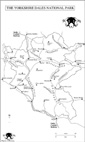
I59
- The Yorkshire Dales National Park |
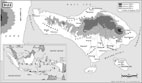
I60
- Bali |
 |
 |
 |
 |
|
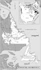
I61
- Newfoudland
|
I62
- Global Trade (West)
|
I63
- Global Trade (East)
|
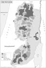
I64
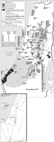
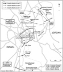
- The West bank
|
 |
 |
 |
 |
|
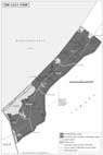
I65
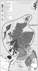
- The Gaza Strip
|
I66
- Scotland, C18
|
I67- Aghanistan
(provinces)
|
I68
- Burma
(provinces)
|
 |
 |
 |
 |
|
I69
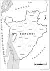
- Burundi
(provinces)
|
I70
- Yugoslavia
|
I71 - Sudan
(provinces)
|
I72- - Internally Displaced Persons
|
|
|
|
|
|
 |
 |
 |
 |
|
I73 - IDP
concentrations
in Colombia, 2002
|
I74- Minorities
in and around Kosovo
|
I75- Clashes
and Displacement in the Pilippines,
2001
|
I76- Relocation
in Burma, 2001
|
|
|
|||
 |
 |
 |
 |
|
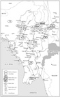
I77- Conflict
and Displacement in Nigeria, 2001
|
I78- Kurds
in Iraq
|
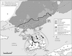
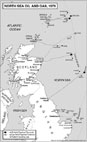
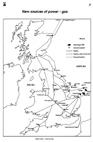
I79- North
Sea Oil and Gas, 1979
|
I80- Main
U.K. ports, 1974
|
|
|
|||
 |
 |
 |
 |
|
I81- Yugoslavia,
1990-2002
|
I82- European
Union, Applicants 2002
|
I83- Athos
Monasteries
|
I84- The
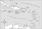
Caribbean
|
 |
 |
 |
 |
|
I85-Battle
of Naseby
|
I86- Battle
of Trafalgar
|
I87- Central
India, 1857
|
I88- Zululand
|
 |
 |
 |
 |
|
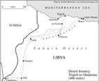
I89- Northwest
Libya
|
I90- Brazil
|
I91- Tajikistan
|
I92- The
Taba offer, according to Palestinians
|
|
|
|
|
|
 |
 |
 |
 |
|
I93- Exeter
|
I94- Exeter
(land)
|
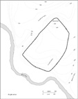
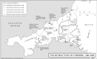
I95- Retraction
of Cornish
|
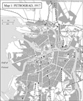
I96- Petrograd
|
 |
 |
 |
 |
|
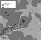
I97- Town
of European USSR, c.1930
|
I98- Mythical
Rome
|
I99- Rome
|
I100- Latium
|
 |
 |
 |
 |
|
I101- Northern
Italy
|
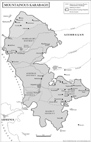
I102- Armenia
with Karabagh
|
I103- Mountainous
Karabagh
|
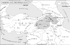
I104- Armenia
in the Middle East
|
 |
 |
 |
 |
|
I105- The Normandy landing
|
I106- Waterloo
|
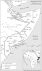
I107- Somalia - Somaliland
|
I108- Weimar Germany
|
 |
 |
 |
 |
|
I109- Communist
vote
in Germany,
1930
|
I110- Nazi
vote
in Germany,
1933
|
I111- Unemployment
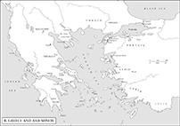
in Germany, 1932
|
I112- Regional
elections in Germany, 1930-33
|
 |
 |
 |
 |
|
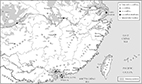
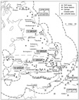
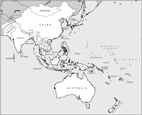
I113- Countries of Asia and Oceania |
I114- Countries of Asia and Oceania (sectional) |
I115- Countries of Africa |
I116- Countries of America |
 |
 |
 |
 |
|
I117- Countries of Europe and Central Asia
|
I118- Countries of Europe and Central Asia (sectional)
|
I119- Countries of the Middle East
|
I120- Countries of the Middle East (sectional)
|
 |
 |
 |
 |
|
I121
- Hungarians in Catalonia
|
I122
- Hannibal in Catalonia
|
I145
- Sheol
|
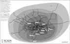
I146
- Scion
|
 |
 |
 |
 |
|
I147
- Kiel
|
I148
- Munich
|
I149
- Berlin (West)
|
I150
- Berlin (East)
|
 |
 |
 |
 |
|
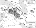
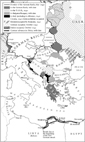
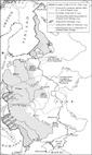
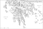
I151
- Greece, Aegean
|
I152
- Persian Empire
|
I153
- Austria and neighbours
|
I154
- Ardennes
|
 |
 |
 |
 |
|
I155
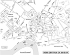
- Assaye
|
I156
- Blenheim
|
I157
- Bunker Hill
|
I158
- El Alamein
|
 |
 |
 |
 |
|
I159
- Normandy, 1944
|
I160
- Waterloo
|
I161
- Roergue
|
I163
- Crossing at Moulins
|
 |
 |
 |
 |
|
I164
- Auvergne garrison
|
I166
- Normandy castles
|
I167
- Saint-Malo
|
I168
- Fight in Flanders
|
 |
 |
 |
 |
|
I169
- Siege of Nantes
|
I171
- Invasion of Castile
|
I172
- Invasion of Portugal
|
I176
- Percy rebellion
|
 |
 |
 |
 |
|
I177
- Gascony
|
I178
- Montereau
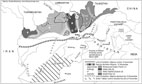
|
I180
- Helmand province
|
I181
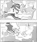
- Asia, C2 B.C.
|
 |
 |
 |
 |
|
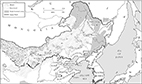
I182
- Asia, C9
|
I183
- Asia, C17
|
I184
- Asia, 2010
|
I185
- Grasmere
|
 |
 |
 |
 |
|
I186
- Normandy landing
|
I187
- Wars of the Roses I
|
I188
- Wars of the Roses II
|
I189
- Baghdad, religions
|
 |
 |
 |
 |
|
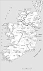
I190
- Ireland
|
I191
- Bayu
|
I192
- Beirut
|
I193
- Lebanon, 1975–90
|
 |
 |
 |
 |
|
I194
- Belfast
|
I195
- Central Belfast
|
I196
- Belfast, communal
|
I197
- Northern Ireland
|
 |
 |
 |
 |
|
I198
- Wagram
|
I199
- Austerlitz
|
I200
- Jena
|
I201
- Eylau/Friedland
|
 |
 |
 |
 |
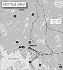
|
I202
- Campaigns in Iberia
|
I203
- Norway
|
I204
- Oslo
|
I205
- Siege of Malta
|
 |
 |
 |
 |
|
I206
- Lepanto
|
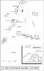
I207
- Athen’s Agora
|
I208
- Greece, Asia Minor
|
I209
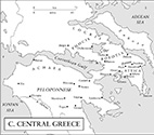
- Central Greece
|
 |
 |
 |
 |
|
I210
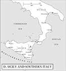
- Sicily, S. Italy
|
I211
- Italy, Mediterranean
|
I212
- Constantinople 1203–4
|
I213
- Venice
|
 |
 |
 |
 |
|
I214
- Venice, Lagoon
|
I215
- Chioggia war
|
I216
- Siege of Chioggia
|
I217
- Moscow
|
 |
 |
 |
 |
|
I218
- Russia
|
I219
- South America
|
I220
- Gibraltar
|
I221
- Gibraltar area
|
 |
 |
 |
 |
|
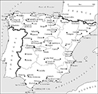
I222
- Spain
|
I223
- Bunker Hill
|
I224
- Battle of Camden
|
I225
- Guilford Courthouse
|
 |
 |
 |
 |
|
I226
- Road to Concord
|
I227
- Siege of Boston
|
I228
- Carolina campaigns
|
I229
- Yorktown
|
 |
 |
 |
 |
|
I230
- Bound Brook
|
I231
- Brandywine
|
I232
- Eastern Seaboard
|
I233
- Long Island
|
 |
 |
 |
 |
|
I234
- Relief (Europe)
|
I235
- Rome
|
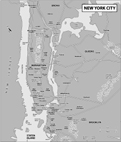
I236
- New York City
|
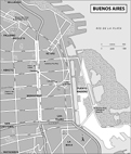
I237
- Buenos Aires
|
 |
 |
 |
 |
|
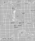
I238
- Central Beijing
|
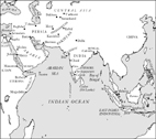
I239
- Indian Ocean
|
I241
- Budapest, 1956 (West)
|
I242
- Budapest, 1956 (East)
|
 |
 |
 |
 |
|
I240
- Yugoslavia
|
I243
- Hellenistic world
|
I244
- Northern Greece
|
I245
- Southern Greece
|
 |
 |
 |
 |
|
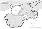
I246
- Piraeus
|
I247
- Attica garrisons
|
I248
- Greater Egypt
|
I249
- The Chremonidean war
|
 |
 |
 |
 |
|
I250
- Caithness
|
I251
- Athos
|
I252
- Kiel
|
I253
- Munich
|
 |
 |
 |
 |
|
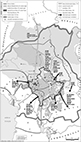
I254
- Berlin (West)
|
I255
- Berlin (East)
|
I256
- Central Rome, c. A.D. 200
|
I257
- Budapest, 1956
|
 |
 |
 |
|
|
I258
- Hungary 1945–56
|
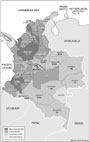
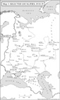
I262
- Dauphinist garrisons
|
I264
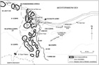
- Italy and the Mediterranean
|
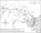
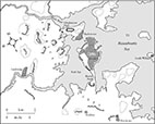
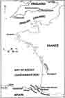
As it used to be (a few scanned images of maps that I have both compiled and drawn by traditional means): top, next, previous
 |
 |
 |
 |
|
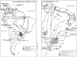
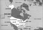
J1
- America in the 18th century |
J2
- The Coming of the Hungarians; Ottoman Domination in Hungary; The Austro-Hungarian
Empire 1867 - 1918 |
J3
- The Angevin Empire c. 1200 |
J4
- Bernadotte’s Europe |
 |
 |
 |
|
|
J5
- Europe after the Treaty of Utrecht (1713) showing the cities visited
by Handel |
J6
- The Mediterranean World: Physical |
J7-Europe,
1837
|
J8
- The Communist Bloc, 1922-49
|
 |
 |
 |
 |
|
J9
- Central Europe, 1915; the Balkans, 1915
|
J10
- Africa in 1902
|
J11- Religions and frontlines in Lebanon
|
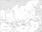
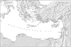
J12- The Silk Roads
|
|
|
|||
 |
 |
 |
 |
|
J13
- England and her neighbours in the reign of Henry VIII
|
J14
- Rulers of Corsica, 3C BC-AD 725; 725-1987
|
J15
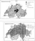
- Swizerland, 13C-1802; 19-20C
|
J16
- Germany in the Later Middle Ages
|
 |
 |
||
|
J17
- Indian population of Guatemala
|
J18
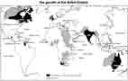
- Growth of the British Empire
|
As it used to be (a few scanned images of maps that I have drawn to order by traditional means): top, next, previous
 |
 |
 |
 |
|
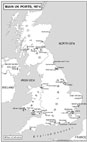
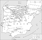
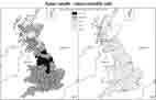
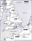
K1
- British gas |
K2
- Public Health |
K3
- Siege of Bilbao |
K4
- The Western Provinces; North Africa |
 |
 |
 |
 |
|
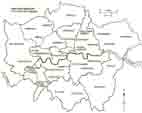
K5-
- London Boroughs
|
K6
- Fighter Command areas
|
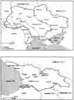
K7
- The Ukraine, Georgia
|
K8
- Cevennes
|
 |
 |
 |
 |
|
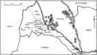
K9
- The war in Lebanon, 1982
|
K10
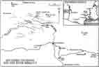
- Israeli withdrawal from Sinai
|
K11- Israel
|
K12
- Mesoamerica
|
 |
 |
 |
 |
|
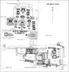
K13
- The Great Plaza
|
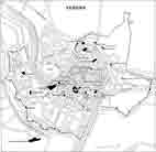
K14
- Verona
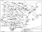
|
K15
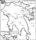
- Hispania
|
K16
- The Peloponnese
|
 |
 |
 |
 |
|
K17
- The Roman Empire under Diocletian and his Successors
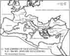
|
K18
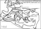
- The Barbarian Invasions of the 5th Century
|
K19
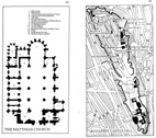
- The Matthias Church; Budapest, Castle Hill
|
K20
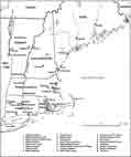
- Houses of New England
|
 |
 |
 |
 |
|
K21
- The Viceroyalty of Peru, c. 1650; |
K22
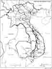
- The War against the French: Northern Vietnam; |
K23
- Indochina
|
K24
- Eritrea
|
 |
|||
|
K25-United
States
|
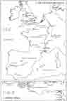
The distant past (a few scanned images of maps published in Hungary that were drawn by others based on my compilation and instruction): top, previous
 |
 |
 |
 |
|
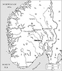
L1
- Expansion of Habsburgs by 1556 |
L2
- Habsburg Empire 1809-1918 |
L3
- The Austro-Hungarian Monarchy and Balkans |
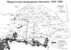
L4
- Demarcation Lines, Neutral Zones in Hungary, November 1918 - March 1919 |
 |
 |
||
|
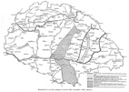
L5-
Hungary, administration 1854-60
|
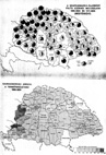
L6-
Distribution of Cattle by counties; Proportion of Cattle to Arable Land
by counties (in Hungary)
|